 “Half of your group won’t summit, the altitude sickness will greatly affect most of you!’’ said one friend that had hiked Muhavura before. “Hiking Mount Muhavura can be equated to ascending and descending portal peak of the Ruwenzori’s’’, another friend commented, arising vivid memories of the difficulties I had endured hiking the portal peak in July last year. “Mount Muhavura is not a joke, are you sure you want to attempt it right now or do you want to hold on a bit till you are much fitter?’’ another hiker mentioned when I asked for his opinion. All three opinions seemed honest yet disappointing at the same time. Either way I had made up my mind, after hiking Mount Gahinga and Mount Sabinyo in the previous year, the urge to conquer the highest of the Virunga Mountains in Uganda was great. The mountain was calling and I had to go…
 Five of us from the Mountain Club of Uganda (MCU) set off to Kisoro from the Lugogo parking lot at about 1pm on Friday the 25th of May. We spent half of the time getting to know each other as none of us had ever met before, I was thrilled to hear stories from USA, Bolivia, Colombia, Bangladesh and Germany as the group had travelled quite a lot over the world. We spent the other half of our time singing along to music in the van and stopping along the way for roasted goat meat and other roadside delicacies. After a bit of a struggle in locating the Mgahinga National Park we finally arrived and were checked in to our accommodation by 3am; we only had a few hours to sleep and had to be up and ready by 7am to start the hike.
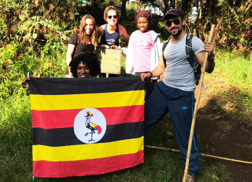
As Katharina opted to hike Mount Sabinyo the rest of us jumped in to the van and drove towards the starting point of Mount Muhavura. After paying for our hiking permits and getting a briefing from the guides, we posed for a group photo with the Ugandan flag, grabbed a few bamboo sticks to aid in our hike and begun our ascent at around 8.30am. As one of us sped off with one guide, I advised Rae and Juliana to take it easy , I never find it wise to begin a hike with speed regardless of how easy it seems at the start. In my opinion it’s always important to conserve energy and strength for the strenuous tasks that lie ahead or above. Luckily they saw sense in my reasoning and we all hiked as a group at a moderate pace, Michael our guide diligently followed from the back allowing us to take the lead.
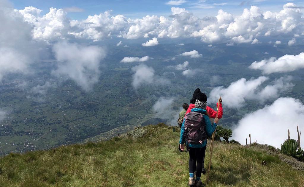
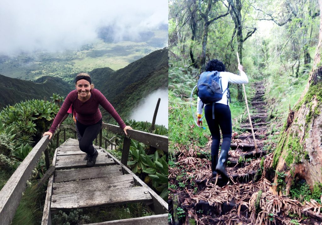
We took the opportunity to share our opinions about politics, religion, cultures, languages, accents and various other interesting topics in our various countries of origin as we walked along trails carpeted with short grasses and small shrubs. The heat from the sun was slowly raining down on us like a breath from hell, prompting us to take a few water breaks to rehydrate, chocolate bars came in quite handy too, as the sugar helped boost our energy levels. As we hiked towards the first hut, we spoke much less, our breathing got a bit heavier as we slowly started feeling the impact of the steepness on our legs. We climbed a few ladders and were finally relieved to get to the first hut at an altitude of 3,116m/10,233ft above sea level and get a break.
 “If you girls are not at the summit by 1.30pm, I will be forced to cut short the hike and ask you to descend!’’Michael warned breaking the 10 minute silence at the hut. We had all pulled out some delicious sandwiches and had started appreciating the cool breeze that was helping us cool off from the gruesome heat. “I suggest we stand up immediately and keep on hiking, it is still a long way ahead’’, he continued to say as we slowly stood up and begun the ascent towards the second hut.
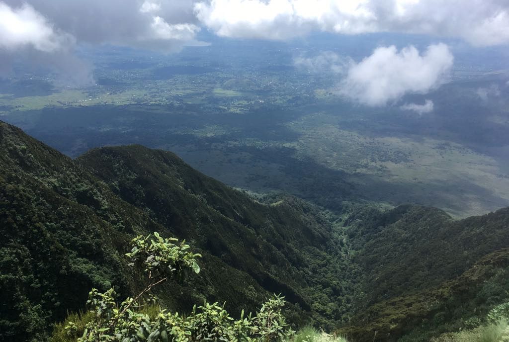
The paths towards the second hut were quite rocky and bushy at the same time. There were several ladders to climb that made us think they would never end, fatigue started to set in, knees and legs started to hurt a bit, the dehydration increased, altitude sickness effects started to slowly click in. As soon as we got to the second hut at 3,855m/12,648 ft above sea level we fell down on the ground in relief. The distance between the first and second hut was about 739 meters.
After a 10 minute break, we jointly agreed to soldier on to the summit point. “Between the second hut and the summit is the toughest and steepest part of the mountain. But I see plenty of strength in you ladies, you will make it!’’ Michael encouraged as we slowly ascended.
He was right; life suddenly became dis-tasteful! The cold became unbearable forcing us to pull out warm gear from our back packs. Intense headaches and dizziness became part of the summiting process, the steepness greatly accelerated with every ladder we climbed, our energy levels were slowly diminishing and we were as thirsty as camels that have walked through deserts for several months. We walked silently as fatigue began to overwhelm us. Just when we thought this trying moment would never end we saw the Uganda-Rwanda peak sign post and breathed a sigh of relief.
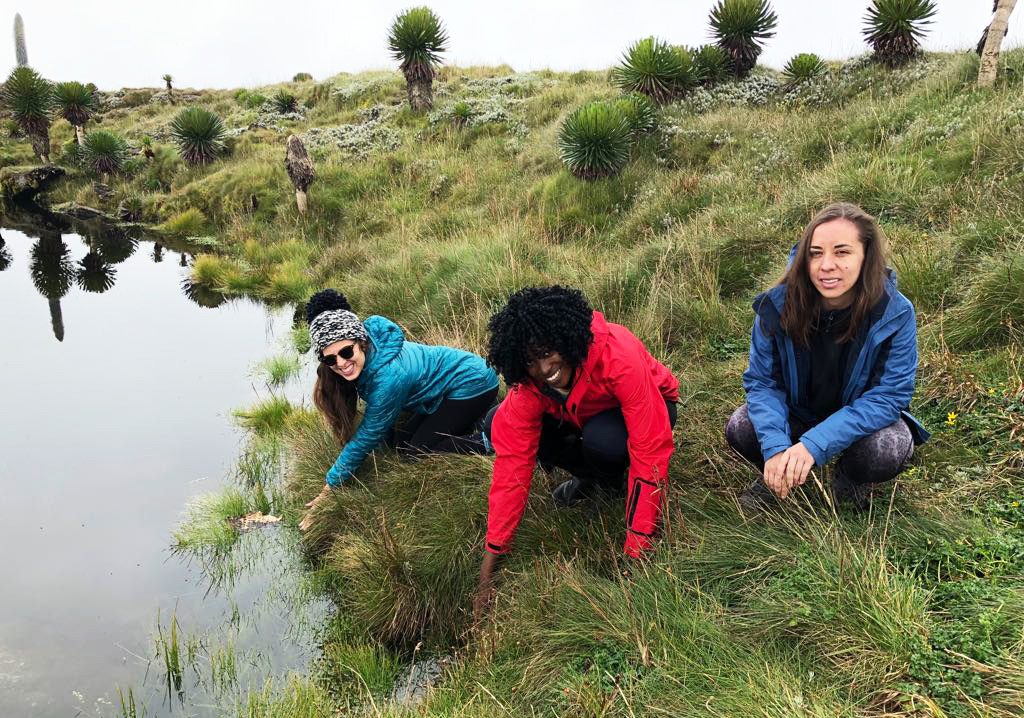
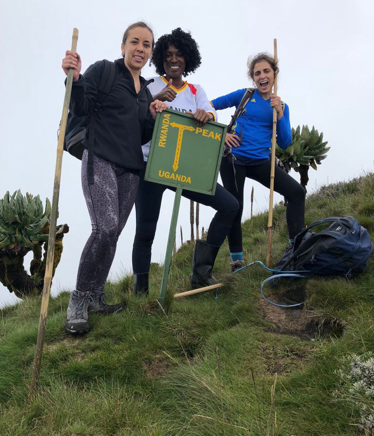 “Congratulations, ladies!’’ Michael said as we rushed to take photos next to the Crater Lake and the massive green post that confirmed we were at the summit. It was a good feeling for all of us, a feeling of victory, great team efforts and commitment. We walked around the Crater Lake in excitement, Rae fell asleep for a few minutes to relax her body, Juliana was quietly seated munching cheese sandwiches with Michael and after about 15 minutes our descent begun. We thought the descending process would be much easier but were proved wrong. We had to go really slow to avoid slipping along the trails, our knees and toes were hurting from long hours of walking downwards. As soon as we got to the first hut, our headaches were gone; it was a good feeling of assurance that we were making progress back to base.
 At exactly 8.30pm we were seated silently in the van that we had hired from Kampala. Our driver had a million questions to ask, but eventually gave up as we were all too tired to respond. Our bodies ached, our legs felt paralyzed, our stomachs growled in hunger, we were cold and covered in sweat and dirt. As soon as we got back to the lodge we were welcomed back with a warm delicious meal, hot tea and coffee, a cozy fireplace to warm up and smiles from the staff congratulating us and acknowledging our strength. “Many people never make it to the summit, you ladies are brave!’’ one of the workers said to us as he carried buckets of hot water to the bathroom for us.
 We re-united with Juan who had descended the mountain faster than the three of us and Katharina who had successfully conquered Mount Sabinyo. Everyone was happy and content by the end of the day. The MCU mountain beasts had emerged victorious.
The following is essential for the hike:
- Water proof quality boots or long gumboots.
- Light weight back pack-Hikers should ensure to pack as lightly as possible especially if they prefer to carry their own bags during the hike. The weight of a heavy back pack is troublesome and plays a great role in slowing one down.
- A head cap for sun/rain protection.
- A hand watch
- Sun-glasses
- Light rain jackets/ponchos preferably with a hood and water proof pants
- A camera/phone camera
- Walking sticks/bamboo sticks are always provided from the office at no fee.
- Long sleeved shirts and pants.
- At least 2 liters of drinking water.
The Uganda Wildlife Authority (UWA) hiking fees for any of the Virunga Mountains in Uganda i.e. Mount Mgahinga, Mount sabinyo or Mount Muhavura are as follows;
- Foreigner non-residents is USD 80
- Foreign residents is USD 70
- Ugandan Nationals is UGX 50,000
Hiking Mount Mgahinga is a good option for beginners, but Mount Sabinyo and especially Mount Muhavura require hiking experience due to their steepness.