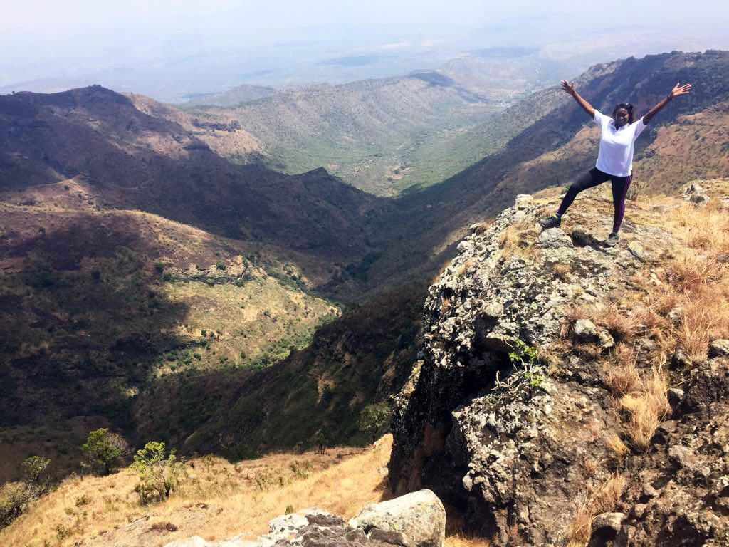
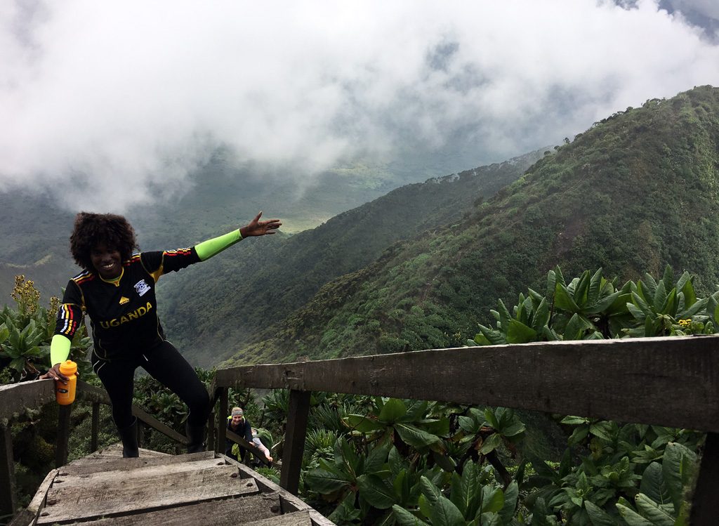
Mountain climbing is an attractive activity that has unfortunately not been fully explored by Ugandans and yet Uganda is blessed to have a series of spectacular mountains like Moroto, Kadam, Morungole, Zulia, Lower Imatong and Langia which are located in the Karamoja, Moroto, Kaabong and Nakapiripirit regions of the North Eastern part of Uganda and can be hiked within a day or two. Local guides and porters can be hired at a small fee to lead hikers through the trails and assist in carrying heavy luggage. This acts as a positive gesture of giving back to the community.
 Mount Moroto has a beginning elevation of 1,724m and a summit point of 3,082m at Sokodek Peak. Hikers can also decide to hike and stop at the third highest peak on this mountain known as the Imagit Peak that stands at a height of 2,930m.The total ascent and descent of the mountain is about 1,950m a distance of approximately 26 kilometers. Mount Moroto can be hiked in a day for roughly 10 hours, 8.5 hours spent hiking and 1.5 hours resting. The number of hours spent climbing is usually determined by the pace set up by the hikers. It is greatly advisable to camp for a night below Imagit Peak which is quite pleasant as there is a possibility of fetching water from surrounding sources at most times of the year. It’s also a good stop that provides ample rest to hikers enabling them to preserve their energy for their descent the next day.
Mount Napak has a starting elevation of 1,268m from Pilas Primary School and a summit elevation of 2,530m. One section of the trail at Mount Napak is extremely steep with a scramble section that can be climbed with the aid of a 15 meter rope. This steep section demands rock climbing moves and it would be a great advantage for the hikers if they possessed some of these skills. Mount Napak trek is a distance of about 18.9km and it would require about 10 hours to ascend and descend this mountain with about 8 hours spent hiking and 2 hours taking breaks in between the hike; depending on the pace of the hikers. This mountain can be hiked within a day or two, again depending on the preference and capability of the hikers.
Mount Kadam stands at a height of 3063 meters tall with a summit peak known as Libo. Kadam was previously named Debasien and Tabasiat during the colonial period and is the second highest mountain in the Karamoja region. Kadam has a number of trails that can be used by hikers, with hiking for 2 days and camping on the mountain for 1 night highly recommended.
Mount Morongule is also known as Ikland because the smallest, yet one of the most unique tribes in Uganda known as the Ik, reside at the base of this mountain. Mount Morongole also pronounced Moroungole or Morungole is 2,749 meters high, has a smooth terrain but is quite a long hike. Depending on one’s pace it would take anything between 8-13 hours of climbing and resting to ascend and descend the mountain.
Mount Zulia which is 2,149m can be hiked in a day as well as the Lower Imatong Mountains. Mount Langia which stands at a height of 3,029m can be hiked in a day or two. The months running from September up to February are considered to be the most favorable months to venture into hiking within this region. It is however not recommendable for beginners, as both rock & mountain climbing experiences are required.
The following is essential for the hike:
- Quality hiking boots
- A Quality back pack
- A hand watch
- Sun-glasses
- A long pair of thick socks
- Long sleeved pants and shirts (to act as protection from thorn pricks from the bushes along the hiking trails).
- Sunscreen for skin protection (the heat in this region tends to be extreme especially between December-February).
- A hat or cap to offer protection from the hot sun.
- Plenty of drinking water at least 2 liters (one can also fetch water along some streams on the way, however they need to be purified with purification tablets).
- Oranges for vitamin c, chocolate bars and salty snacks are also handy to replace the nutrients lost during the hike.
- Altitude sickness tablets like Diamox and Acetazolamide come in handy for hikers who suffer from Altitude sickness. Medication is best when taken a day before the hike or at the start of the hike.
- A sleeping bag, a tent, and all the necessary beddings required. (if hiker’s choose to spend a night at the mountain)
- A head torch comes in handy especially in the night.
- A camera/phone camera to capture the breath taking views encountered during the hike.
- A fully charged power bank to re-charge one’s phone comes in very handy.
- Toilet paper/wet wipes/hand sanitizer/face towel/Tooth paste & brush- Hikers should not expect to have a bath/shower at the mountain.
- A small cooking stove, utensils and easy to prepare meals for dinner and breakfast- This is for the hikers who prefer to spend a night at the mountain.
- A trash bag that will be used to collect litter. It’s important for hikers to conserve the environment and leave it clean.
- Hikers can carry small quantities of salt, soap and biscuits to give to the communities residing at the bases of the mountains. This is usually a kind gesture towards the locals that is always highly appreciated. However, this is not compulsory!
 Mount Sabinyo, Mgahinga and Muhavura/Muhabura are part of the chain of the Virunga ’’volcanic’’ mountains that are spread across the borders of Rwanda and Congo. These three are situated within the Mgahinga National park in the Kisoro region of the South western part of Uganda and are best hiked in January, June-September and December as these months are drier, making hikes along the trails much easier. However the weather in this area can be very unpredictable with heavy rains pouring regardless of the season.
Mount Sabinyo derives its name from a local Kinyarwanda word “iryinyo” which means tooth. The mountain has 3 peaks with the highest summit standing at a height of 3,645m (11,959 ft) a unique point where the three borders of Uganda, Rwanda and Congo meet .The ascent gets steeper as one approaches the highest peak and should be avoided during the rainy season as the trails get muddy and slippery making it harder to maneuver along the trails. Hikers require between 8-12 hours to ascend and descend the mountain, this greatly depends on their pace. Mount Sabinyo is best hiked by individuals with some form of climbing experience as some parts are quite steep with several ladders to climb up and down.
Mount Gahinga’’pile of stones’’ as the name translates from the local Kinyarwanda/Rufumbira local dialect lies between Mount Muhabura/Muhavura and Mount Sabinyo at a height of 3,474m(11,464 ft) ranking it the smallest of the three mountains and easiest to summit. An ascent and descent on Mount Gahinga would take between 6-10 hours depending on one’s pace; it’s a comfortable hike one highly recommendable for first timers and individuals who suffer from altitude sickness or vertigo. A beautiful swampy caldera that is believed to be about 180 meters wide lies at the top, a great spot to pull out one’s camera and capture memorable shots.
Mount Muhavura also pronounced Muhabura means ‘’the guide’’ in the local dialect is an extinct volcano that stands at a height of 4,127m (13,450 ft) and can be hiked from either Uganda or Rwanda. Mount Muhavura is the steepest and most strenuous of all the 8 volcanic mountains in Uganda, Rwanda and Congo. As much as it can be hiked in one day, hikers are expected to be physically fit as hiking this particular mountain is not a joke, hence should not be treated lightly. Hikers are rewarded with the stunning beauty of a crater lake at the summit coupled with jaw-dropping views of the Ruhondo and Burera twin lakes and other distant volcanic mountains.
The following is essential for the hike:
- Water proof quality boots or long gumboots.
- Light weight back pack-Hikers should ensure to pack as lightly as possible especially if they prefer to carry their own bags during the hike. The weight of a heavy back pack is troublesome and plays a great role in slowing one down.
- A head cap for sun/rain protection.
- A hand watch
- Sun-glasses
- Light rain jackets/ponchos preferably with a hood and water proof pants
- A camera/phone camera
- Walking sticks/bamboo sticks are always provided from the office at no fee.
- Long sleeved shirts and pants.
- At least 2 liters of drinking water.
- Light snacks like Oranges, apples, juices, chocolate bars, crisps, sandwiches, and cakes etc –Hikers should avoid eating heavy meals during the hike. Sugar and salts help in replacing the nutrients lost from the body during the hike.
- Altitude sickness tablets like Diamox or Acetazolamide that help curb the negative effects of altitude sickness should be swallowed a day or morning before the hike.
- Sunscreen for skin protection
- Toilet paper/wet wipes/hand sanitizer
- Trash bags for litter collection.
Armed UWA (Uganda Wildlife Authority) guides always lead the hikers along the trails and also chase away elephants, buffaloes and any other wild animals that may be encountered during the hike, it’s important to remember it’s a National park hence should not be littered.
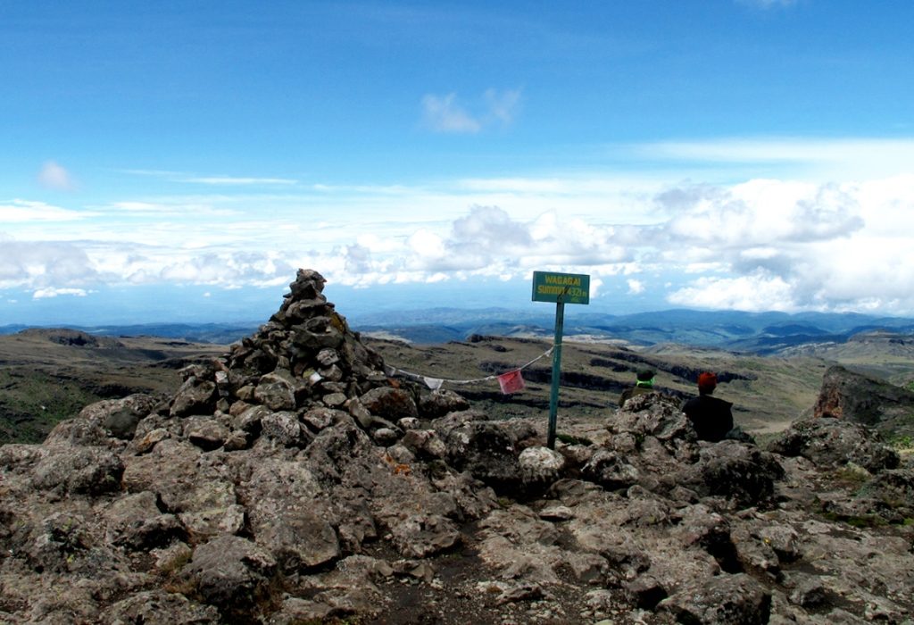
 Mount Elgon located on the Uganda-Kenya border stands at a height of 4,321m (14,176 ft) and is believed to be the largest and oldest solitary volcanic mountain in East Africa and one of the largest volcanic bases in the world. The mountain consists of 5 major peaks Wagagai at 4,321m, Sudek at 4,302m Koitobos at 4,222m, Mubiyi at 4,211m and Masaba at 4,161m.
Mount Elgon can be hiked from either the Ugandan or Kenyan side over a period of 3-5 days to the highest peak of Wagagai depending on the hikers’ pace and route chosen for the hike. Hikers have an option of hiring porters who are locals of the surrounding communities to help carry their luggage and prepare their meals at a small fee. Armed Guides are also provided to lead and protect the hikers from any dangers that may be encountered during the trek .The Mountain offers a unique opportunity of walking along trails that boast spectacular view points, wildlife, caves, waterfalls and hot springs.
The following is essential for the hike:
- Quality hiking boots –It is highly recommendable for hikers to carry at least 02 pairs of boots as this is a long hike.
- A Quality back pack
- A hand watch
- Sun-glasses
- Long pairs of thick socks
- Long sleeved pants and shirts (to act as protection from thorn pricks from the bushes along the hiking trails) and enough clothing to last the days spent hiking at the mountain.
- Sunscreen for skin protection (the heat in this region tends to be extreme especially between December-February).
- A hat or cap to offer protection from the hot sun.
- Plenty of drinking water (one can also fetch water along some streams on the way, however they need to be purified with purification tablets).
- Oranges for vitamin c, chocolate bars and salty snacks are also handy to replace the nutrients lost during the hike.
- Altitude sickness tablets like Diamox and Acetazolamide come in handy for hikers who suffer from Altitude sickness. Medication is best when taken a day before the hike or at the start of the hike.
- A sleeping bag, a tent, and all the necessary beddings required.
- A head torch comes in handy especially in the night.
- A camera/phone camera to capture the breath taking views encountered during the hike.
- A fully charged power bank to re-charge one’s phone comes in very handy.
- Toilet paper/wet wipes/soap/hand sanitizer/face towel/Tooth paste & brush- There might be a possibility of having a bath if the guides are in position to locate a nearby water source. They will provide hikers with basins and jerry cans to bathe.
- A small cooking stove, utensils and easy to prepare meals for dinner and breakfast- This is for the hikers who prefer to spend a night at the mountain.
- A trash bag that will be used to collect litter. It’s important for hikers to conserve the environment and leave it clean.
Tents and sleeping bags can be rented at a small fee; hikers should consult the Mount Elgon officials to organize this for them. However, it’s largely advisable for hikers to have their own personal beddings with them.
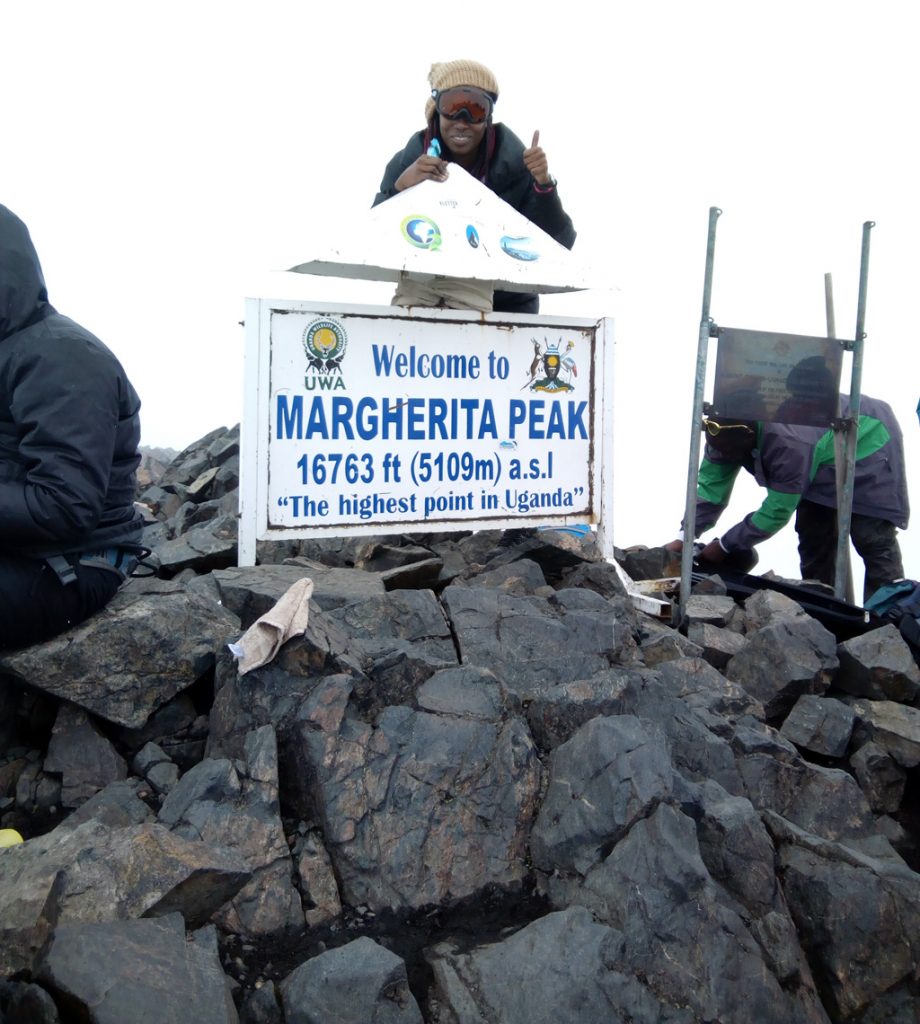
 The Rwenzori mountain is a world heritage site that lies on the Uganda-Congo border and is ranked as Africa’s third highest mountain with its highest peak(Margherita peak) on Mount Stanley reaching an elevation of 5,109m, along with Mount Speke (4,890 M) Mount Baker (4,844m) Mount Gessi (4,715m), Portal Peaks (4,391m) and the Great Tooth at (4,603m). The park is home to a wide variety of mammal, bird, reptile and amphibian species coupled with pristine and spectacular landscapes that comprise of waterfalls, hot springs and snowcapped peaks. Hiking on Mount Rwenzori can take anything between 1-10 days depending on how much the hikers would want to hike, the routes chosen for the ascent and the respective peak(s).
The following is essential for the hike:
- Quality hiking boots –It is highly recommendable for hikers to carry at least 01 pair of hiking boots and 01 pair of long gumboots for the marshy/ muddy trails.
- A quality back pack.
- A pair of quality hiking sticks
- 2-3 pairs of woolen hand gloves.
- First aid kit with cotton wool, disinfectant, bandages, deep heat ointment/spray- These are usually provided by the trekking companies but always wise for hikers to carry their own kits.
- A hand watch
- Sun-glasses
- Several pairs of long thick socks- The Rwenzori Mountains are very cold, it’s important to keep warm and avoid hypothermia.
- Long sleeved pants and shirts (to act as protection from thorn pricks from the bushes along the hiking trails) and enough warm clothing to last through the days spent hiking at the mountain.
- Sunscreen for skin protection
- A hat or cap to offer protection from the hot sun or rains.
- Plenty of drinking water -one can also fetch water along some streams on the way, the streams at Rwenzori have clean water that is safe for drinking.
- Oranges for vitamin c, chocolate bars and salty snacks are also handy to replace the nutrients lost during the hike.
- Altitude sickness tablets like Diamox and Acetazolamide come in handy for hikers who suffer from Altitude sickness. Medication is best when taken a day before the hike or at the start of the hike.
- A head torch comes in handy especially in the night.
- A camera/phone camera to capture the breath taking views encountered during the hike.
- A fully charged power bank and batteries to re-charge one’s phone/camera comes in very handy.
- Music player and headphones as this is a lengthy and strenuous hike, a bit of music to soothe the soul is always a good idea.
- Toilet paper/wet wipes/soap/hand sanitizer/face towel/Tooth paste & brush- There might be a possibility of having a bath if the guides are in position to locate a nearby water source. They will provide hikers with basins and jerry cans to bathe.
- A trash bag that will be used to collect litter. It’s important for hikers to conserve the environment and leave it clean.
Tents and cabins are in place at the mountain and owned by either the Rwenzori Trekking services or the Rwenzori Mountaineering services depending on which company has been chosen by the hikers. These companies are responsible for ensuring hikers are provided with porters to help carry their luggage, cooks to prepare their daily meals and armed guides to ensure their safety during the hike.
There is a need for more publicity and increased efforts in selling these destinations to Ugandans to curb the negative perception the public has on mountain climbing in the region. One move that can be implemented to make it more attractive is making the activity fees more affordable especially at Mount Elgon & Mount Rwenzori, to encourage more Ugandans to develop an interest in hiking.


9 Comment
Owen Nicholas, Ireland, 2018-05-23 at 11:19 AM
A Very important Guide, We made a last minute decision after reading your guide to hike Mount Elgon which turned out to be one of the highlight of our trip to Uganda.
Our guide, Moses, was informative and the hike was FANTASTIC. There are some areas of scrambling but the guide just built our confidence in tackling them until WAGAGAI
I Would strongly encourage visitors to get more information like this before hand
Pascqa Lorna Abur, 2018-06-05 at 12:57 PM
That is very good news owen! i am so glad that my guide has been helpful to you. I hope you return to Uganda to conquer more mountains. Thank you very much….
Katende Michael, 2018-05-02 at 3:57 AM
Thanks for the Guide and i want to say these are the best hikes available. They can be strenuous. Best to come prepared for all types of weather. And wear proper shoes! We see many unprepared people in potential trouble. But the Hike on any of these places is so rewarding.
Pascqa Lorna Abur, 2018-06-05 at 12:55 PM
Yes i agree! Thank you so much for reading and agreeing with my hiker’s guide. I truly appreciate…..
Matt Sweden, 2018-04-22 at 9:24 PM
How much does it cost to hike mountain Rwenzori? How many days does it take, can you recommend a good guide or company. is there anything you might have left out that can help. Me and my wife are planning to visit Uganda again in April 2019.
Thank you for this wonderful guide.
Pascqa Lorna Abur, 2018-04-26 at 6:43 PM
Hey Matt,
Thank you for reaching out. Kindly email me on pascqalorna@gmail.com so i could give you more detailed information on how best to prepare for your rwenzori hike.
Samson Wananda, 2018-04-19 at 7:47 PM
Wow this Guide to hiking mountains is well explained, thank you writer this helps to explain my travel to the Elgon
Pascqa Lorna Abur, 2018-04-26 at 6:41 PM
You are welcome. Good luck in your Elgon hike.
Pascqa Lorna Abur, 2018-06-05 at 1:00 PM
I am glad my guide has been informative and helpful. Thank you very much and good luck in conquering the mountains.